
Historical Maps
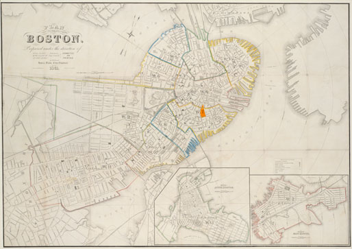
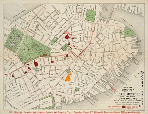
The areas highlighted on each map with an orange overlay show the locaton of the modern day Norman B. Leventhal Park and Post Office Square.
“A New and Correct Plan of the Town of Boston” 1775
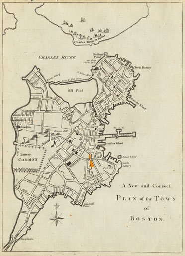
“A New and Correct Plan of the Town of Boston” shows Boston at the time of British occupation – Charlestown is depicted “in Ruins” as it was left after the Battle of Bunker Hill on June 17, 1775, and the City of Boston itself is shown with an emphasis on its fortifications, wharves and batteries. At this time in 18th Century Boston, the area that is now Post Office Square and Norman B. Leventhal Park is a residential neighborhood, with many large mansions and accompanying stables and gardens. Milk and Water Streets are already present, and Hutchinson and Atkinson Streets, which would later become Congress and Pearl, are in their current locations, although they would be widened and straightened over time.
- View full sized map (700k PDF)
“A Plan of Boston” 1796
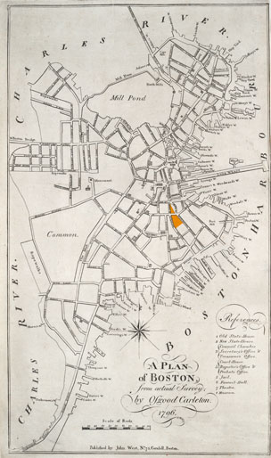
The end of the Revolutionary War can be marked in the changed landscape of Boston’s streets. Name changes and newly designed structures appear in the 1796 “Plan of Boston,” for example, King Street becomes State Street, Long Lane becomes Federal Street, and Franklin Place, or the Tontine Crescent, is designed and built in honor of Benjamin Franklin by architect Charles Bullfinch.
- View full sized map (884k PDF)
“Plan of Boston” 1861 (pre-fire) & “Map of Boston” 1899 (post-fire)
Compare the “Plan of Boston” from 1861 to the following post-fire “Map of Boston” from 1899 to see the alterations made to the business district’s streetscape after the Great Fire of 1872. The waterfront by Long and Central Wharves is filled in with the rubble from the fire, and Atlantic Avenue is extended the length of the waterfront, reaching to Commercial Street by Battery Wharf. The blocks throughout the business district are more evenly spaced and lain out due to stricter city planning and fire codes that are enforced during reconstruction. Franklin Street is extended past Congress Street to Broad Street and Arch Street is extended to Milk Street. The buildings that were located in the triangular shaped block between Congress, Pearl and Milk Streets are destroyed in the fire and the plot of land is left undeveloped. This area becomes known as Post Office Square, which is the current location of Angell Memorial Park.
- View full sized map (1.3mb PDF)
- View full sized map (2.2mb PDF)
“Bird’s-eye view of Boston, showing the burned district,” 1872
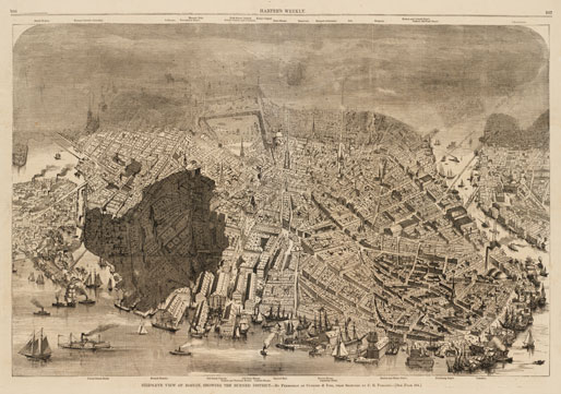
This sketch of the city of Boston was meant to be a published illustration for Currier & Ives, but was acquired by Harper’s Weekly, an American political magazine, from the artist, Charles R. Parsons in the weeks following the Great Fire of 1872. Boston is viewed from the east with a shaded section added to the original sketch to demonstrate the area that was burnt and destroyed by the fire. The area burnt is the modern day financial district, which encompasses the area between Washington, Milk and Broad Streets.
- View full sized map (1.5mb PDF)
From the collections of the Norman B. Leventhal Map Center at the Boston Public Library.
- View a historical photo-timeline of Post Office Square.